![]() As I was lamenting on how long it’s been since I updated my weblog, a thought occurred to me to go check and see if there were any updates on the 2005 schedule for the Bicycle Ride Across Tennessee (BRAT). I rode a portion of the course last year and my plan is to ride the entire course this year, so I’m trying to plan ahead well in advance. Looking over the site, it appears that they’ve made a lot of updates. Although everything is in Adobe Acrobat PDF format, they’ve posted the Release Form, the Daily Rider Registration, Route Description, details on the Accommodations, Food, and even a mini FAQ. The one item missing from the details is a decent map. Wanting to get some idea of the general route, I decided to make my own. I pointed my browser over to
As I was lamenting on how long it’s been since I updated my weblog, a thought occurred to me to go check and see if there were any updates on the 2005 schedule for the Bicycle Ride Across Tennessee (BRAT). I rode a portion of the course last year and my plan is to ride the entire course this year, so I’m trying to plan ahead well in advance. Looking over the site, it appears that they’ve made a lot of updates. Although everything is in Adobe Acrobat PDF format, they’ve posted the Release Form, the Daily Rider Registration, Route Description, details on the Accommodations, Food, and even a mini FAQ. The one item missing from the details is a decent map. Wanting to get some idea of the general route, I decided to make my own. I pointed my browser over to
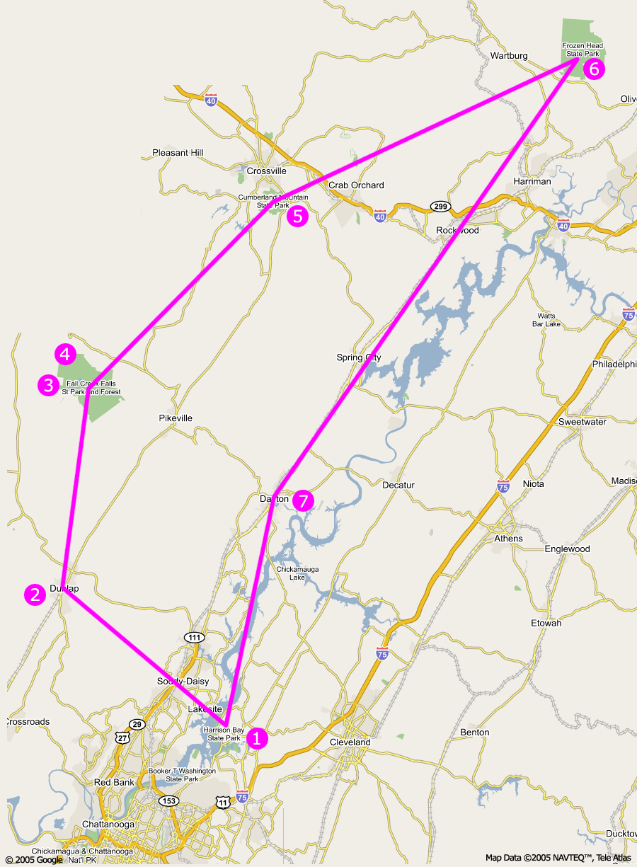
Google Maps and found the starting point, which is at Harrison Bay State Park. Taking a series of screen shots, I created a composite image in Adobe Photoshop. I then drew a path for the rough course, added numbers for each night’s location and then I was done. Piece of cake. Yeah right! When everything was said and done, I think the composite map does give a good overview of the general direction of this year’s course. There’s no elevation information provided on the map, but rest assured it’s very hilly. Anyway, hopefully the work I’ve done will help other people who may be interested in getting a “big picture” perspective, so I’ve posted it here on the weblog.
2005 BRAT Overview Map (188k)
Hope to see you there! 😀
Michael,
I checked the link and everything looks good. I also emailed the link to Pam and Margaret cause they might try to go on the ride as well.
I’ve already asked for the time off and now I’ve got to get into shape so I can pedal more than 1 mile. 🙂